
Total mileage = 833.3
Day 57- Sun Aug 20th
Shelter Cove Resort – Windago Pass
747.6 – 775.9
Windago alternate was 20 miles.
Last night we spent most of the evening on the deck outside of the resort shop and restaurant, sorting out emails and admin + amazon orders further down the trail. Obviously whilst enjoying a few cold beers.
It proved tricky finding the designated thru hiker camp ground in dark.
We left shelter cove at 9:15 am after a tasty breakfast sandwich. Feeling totally refreshed. We spent the morning trying to figure out why we were feeling so fresh.
Maybe it was the short day yesterday, or maybe just the beer, pizza and hearty breakfast? It was great to be back on trail!
We decided to take the Windingo alternate route instead of the PCT. This was the old PCT + we had been advised by others to take it as there was less elevation.
Sarah did a great job of downloading the Gaia mapping app that allowed us to follow the route whilst working offline.
As we have seen before the issue with alternates is that you have no idea about water sources or the elevation heartbeat that you get shown on Far Out App.
We followed the Whitefish Creek trail that lead up Trapper creek. A fast-flowing river that ran into Lake Odell.
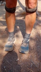
The ground beneath our feet was sandy like a beach intermittent with tree roots. This made for some challenging hiking. Every footstep sliding backwards compounded by the weight of our heavy packs. Sarah complained that I kept kicking up a dust cloud so walked behind at a distance.
After 10 miles around 1pm we stopped for lunch at a Whitefish Horse camp. When taking off your pack at moments like this you are rewarded with almost a weightless sensation and your legs feel like jelly.
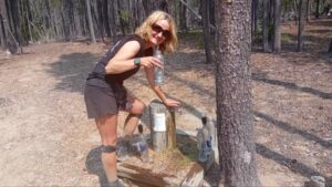
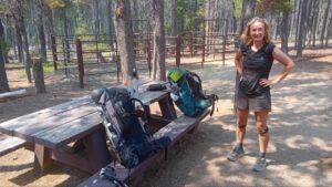
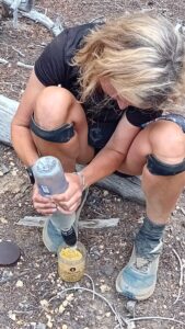
The horse camp featured corals to keep Sarah safely locked up as well as picnic tables and a water spigot with fresh drinking water.
After leaving the Horse camp we followed the Metolius Windigo trail, before taking the Olenburg trail to Windago Pass.
The afternoon stretch of the trail was harder than what we had encountered in the morning with more uphill.
It became an overcast afternoon and smoked lingered in the air with the occasional rumble of thunder in the background.
The forest remained silent as you might expect just before a thunderstorm might break.
The trail has become rather crowded over the last weeks, but today offered a nice contrast where we hardly saw a soul.
Maybe it’s because we took the alternate route or because the bubble of nobos has passed. Trail days is also a hiker festival that is held in Cascade locks during this time, which could also account for the peace and quiet. Either way we are both enjoying having the trail to ourselves for a change.
As the day drew to a close, raindrops started to fall on us. Never heavy enough to warrant waterproofs.
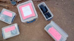
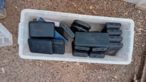
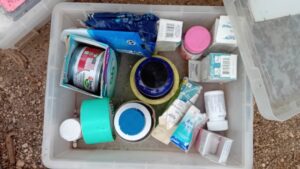
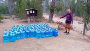
The alternate connected back to the PCT at Windago pass. Here we found a sizeable water cache containing a series of large bottles of water left by a Trail Angel called “Devilfish”. He had also left boxes of battery chargers and other supplies for any passing hikers. What a superstar.
The total mileage of the alternate was 20 miles although this was 3 miles short of the average we need to now hit per day. Although after starting at 9:15 and finishing at 19:00 and still reaching a 20, this wasn’t too shabby.
Looking on the Far Out App it also showed that apart from a spring 6 miles away (which was described as mosquito hell), there wasn’t any water for the next 16 miles.
Therefore we decided to play it safe and pull in for the night and opt for an early start 2mw.







Day 58 Mon Aug 21st
Winago Pass – Water cache Tent site at dirt road
775.9 -805.8
29.9 miles – Although we hiked on an extra 0.2 to smash the 30 mile barrier, before turning back around and returning to the cache. Therefore 30.3 miles covered.
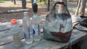
We left Windago Pass at 7am making sure that we stocked up on water for the day carrying 2 liters each.
We’re now approximately 50 miles from Crater Lake our next resupply point.
Although we had also noticed yet another resort called Diamond lodge and a ponderosa in Chemult, approximately 30 miles from winago pass. This was just the motivation we need to try and crank out some big miles today.
By 11am we had already done nearly 10 miles and we were flying. Having music playing in your ears really helps you motor down the trail.
This is something we have tried to avoid so far with the aim to be present in our surroundings, but sometimes needs must to help break up the day.
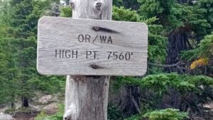
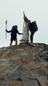
Following on from this 1st stretch the only obstacle in our path was Mt Thielson and a 1000 ft climb spread over 5 miles to Oregons highest point. Before a few smaller ups n downs before the final decent.
We met another Snowbo hiker called Flora along the way. She got her name due to her skills in plant identification.
Her boyfriend is hiking south and started sometime similar to us, but has already reached the Sierras after averaging 50 miles per day. This is insane, although he is going for a speed record.
She also informed us there is meant to be some kind of tropical storm hitting the west coast this evening + it is meant to be a wet day tomorrow.
Over the total day we did approx 4000 ft of ascent and descent. Both exhausted at around 19:30 we reached the next water cache. This was 29.9 miles from where we started the day at Windago pass.
Sarah was keen to officially hit her 1st 30 mile day so we hiked on a little further before turning back to camp at the water cache.
At the start of the day we had aimed to reach the lodge or ponderosa. Although more than happy with today’s effort we opted for an instant mash + stuffing mix with added chicken and gravy. That’ll do nicely!
With full bellies and hatches well and truly battened down we will await the storm.
We have both taken doses of ibuprofen (Vitamin I) as we are both in some pain and discomfort after the big day. A few of Sarah’s toes are starting to feel numb + the index toe on my right foot is the same. Apparently, they call it Christmas toe as the feeling doesn’t generally come back until the Christmas following the hike.





Day 59 Tues Aug 22nd
Water cache Tent site at dirt road – Crater Lake – Mazama village
805.8 – 833.3
Approx 3000ft ascent + descent
23.2Miles
We woke up to find that the storm had not reached us. After dodging the wasps that collect around the plastic bottles of the water cache, we broke camp at around 8ish.
It was a cold start to the day we both rapped up warm and needed gloves to start the day.
We were heading to Crater Lake which is meant to be another PCT highlight.
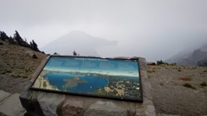
It was formed by a volcano that had collapsed and it’s the deepest body of water in the US famous for its water clarity + aquamarine blue colour.
We took the Rim trail as we hiked towards Crater Lake. We were informed by hikers heading the opposite way that visibility was poor and we would be unlikely to have great views today.
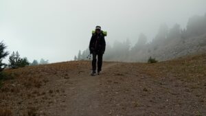
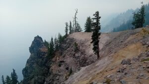
The air was full of mist and smoke from the wildfire which is very synonymous with the Pacific North West.
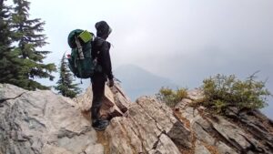
As we neared the Crater it was more like a scene from somewhere like Dartmoor in the UK. Sarah opting to wear pretty much every bit of clothing, including puffy jacket and waterpĺroofs.
A paved road ran around the Rim of the Crater and allowed access to the general public. Mist hung in the air and headlights beamed. This somewhat destroyed the remote wilderness feel.
It was also amusing watching people park up in the parking lots and jump out only to take a quick photo. We got some funny looks as we hiked past with most of the spectators seemingly oblivious to what we were doing.
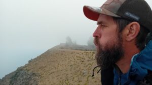
It was cold and water droplets collected in our noses as we peered over the edge. Looking out into the abyss we could make out a series of archipelago islands that were cloaked in the mist.
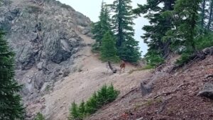
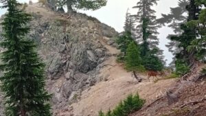
As the day progressed the views improved and we got some better photos than what we had expected. The terrain was something similar to the UK coastline you might find in Cornwall with many short sharp climbs. Deer hunkered down in the rocky outcrops taking shelter from the miserable weather.
We had heard that Valentine and Anton had made it to Mazama village earlier that day. Although we were both surprised to see them hiking through the mist towards us. We dived into some bushes before jumping out on the French duo scaring the living daylights out of them.
Valentine had skipped ahead by grabbing a hitch further down the trail. The pair were now heading back up the Rim trail and planned to camp near Crater Lake. The weather was meant to be improving and they wanted to take in a sunset and sunrise.
Some views you see, some you miss. That’s the magic of the outdoors + I like to think that everyone gets their share in the big scheme of things. Although “Valanton” were hedging their bets by heading back for a second slice of pie.
They also informed us that Anton was heading to Ashland 2mw, skipping the next 80-90 miles. He was having problems with his teeth and urgently need to see a dentist, even talking about heading back to France to get it sorted.
We both hope that this is not the end of these guys and their adventure.
We parted company and headed towards a lodge in Rim village and grabbed a hot cup of three bean beef chilli and a portion of fries.
The lodge a former shadow of what it may been in the past, looking tired and in need of some TLC. Although it was great to warm up and we both left the place with rosey red faces and a warm meal in our bellies.
The hike down to Mazama village was all downhill from there on. We arrived at the store at 20:15. Everything closed at 21:00 so it was like a military operation. Making sure we picked up our last food box and grabbing a meal in the restaurant in time.
After eating we walked into the dark through the large Campground to find the site designated for thru hikers. We were both glad to set the tent up and jump into a warm sleeping bag for the night.














Leave a Reply
You must be logged in to post a comment.